Texas, Louisiana, Oklahoma: Severe TSTM, Flash Flooding and Tornadoes expected
Deutsche Version gibts HIER.
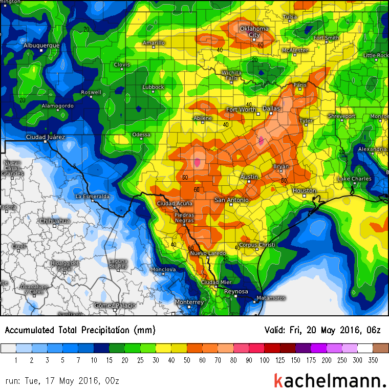
Hello from the other side – Hello from Germany to our english speaking readers. As you may know, at the moment and ongoing this week there is a very energetic air mass above southern parts of North America, a very unstable atmosphere with plenty of moisture. Strong thunderstorms may bring damaging winds above 50 mph, large hail (diameter of 1 inch or larger), couple of tornadoes and accumulated rain until 3 to 5 inches in parts of Texas, Louisiana, Arkansas and Oklahoma.
Yesterday, there have already been some thunderstorms and these weather conditions hold on until Thursday. Our German High Definition Model simulates this rain accumulation until Thursday night:
Our company Kachelmann GmbH on kachelmannwetter.com has produced its own forecast model with a super high resolution of 1 x 1 kilometer! It’s available for Oklahoma and surrounding regions (also for central California and New England!), you can klick it free on our website! You can switch between different time points and zoom in the districts. I have made the most important tweets on our Twitter account:
We have two 360 degrees webcams in OK – one in Oklahoma City and one in Omega.
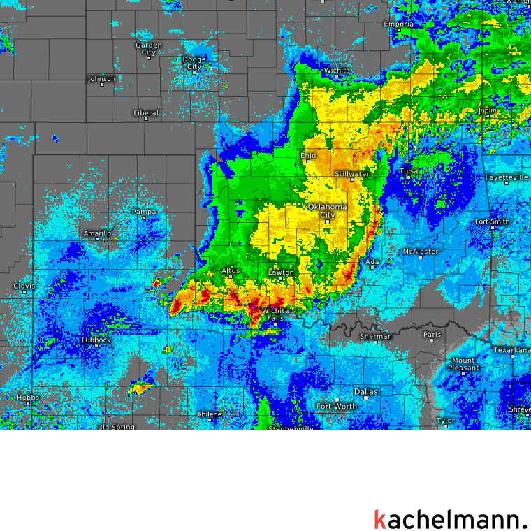
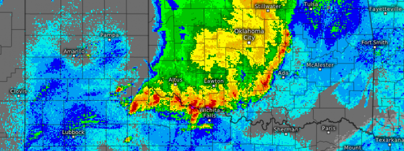
The radar image fom 02:18 CDT shows a very high reflectivity on the border between TX and OK, moving southeasterly:
More weather for you in the near future and also available in englisch – soon on kachelmannwetter.com!
